

Quick answer
Cayo Arena lies in the Bay of La Isabela off the northwestern coast of the Dominican Republic, departing from Punta Rucia village. The sandbar sits roughly 8 kilometers offshore with no fixed dock—boats anchor in shallow water and visitors wade the final meters. Most tours launch from Punta Rucia's main beach between 08:00 and 10:30, with the journey taking 20 to 30 minutes depending on sea conditions.
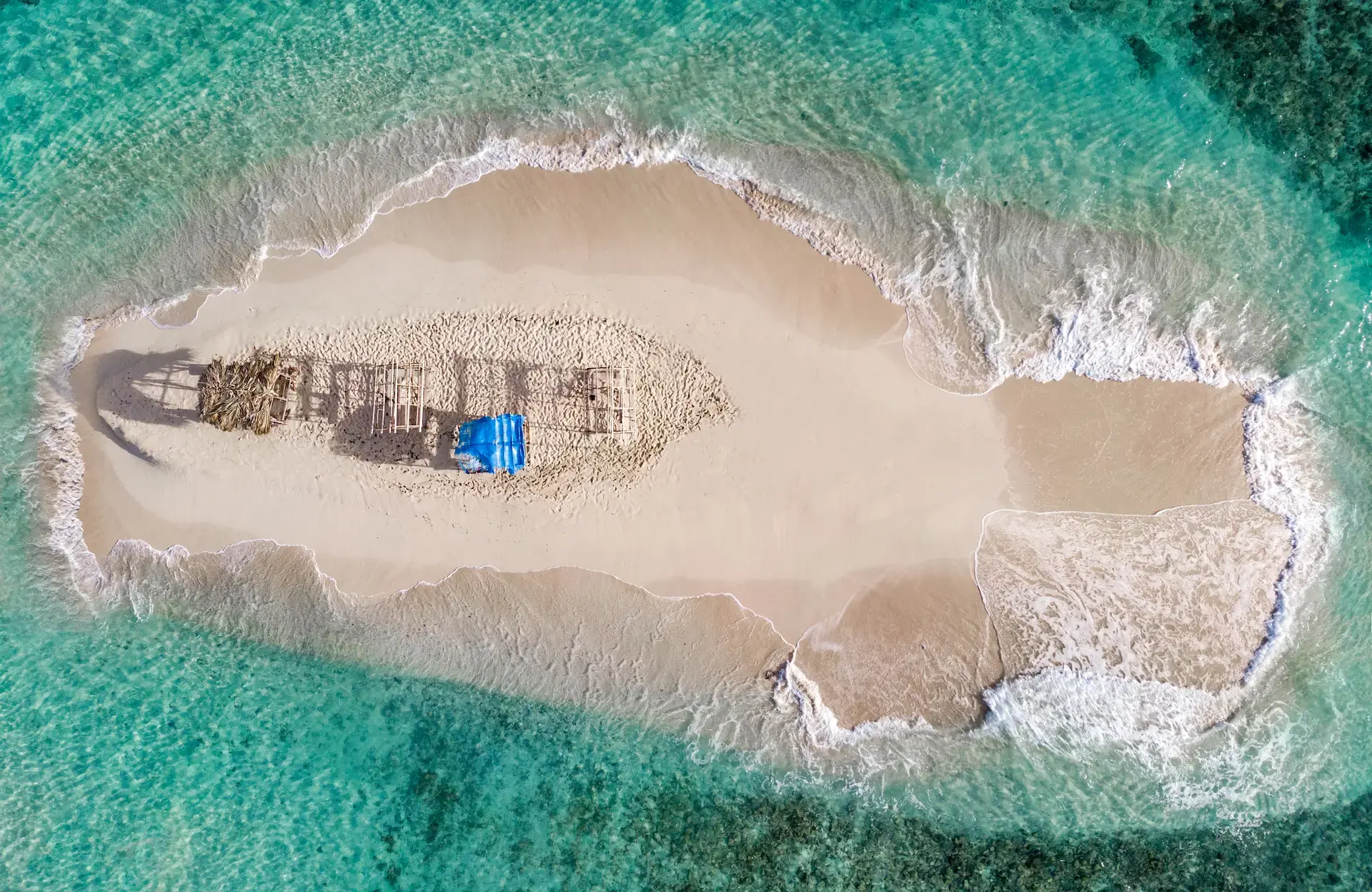
The sandbar known as Cayo Arena occupies a coral-ringed shoal in open water, invisible from shore on hazy mornings. Punta Rucia serves as the sole civilian departure point, a fishing village where the coastal road ends and boat captains negotiate fares at the waterline. No printed chart marks the reef reliably—local pilots navigate by depth changes and the turquoise gradient that signals the shelf edge. Understanding the cayo arena dominican republic map means recognizing that the island itself is a shifting feature: storm surge reshapes the sand, and the swimmable perimeter contracts or expands with tide and swell. The coral head that anchors the formation lies 200 meters east of the main sandbar, marked by a pair of weathered channel buoys. Tour operators approach from the west to avoid the shallow reef, circling to the lee side where depth allows safe anchoring. Visitors disembark into knee-deep water and walk the remaining distance across packed sand. Most navigation apps show Punta Rucia but render Cayo Arena as an unlabeled polygon or omit it entirely. The Bay of La Isabela extends 12 kilometers along this stretch of coast, and the sandbar occupies the bay's midpoint, equidistant from Punta Rucia and the mangrove channels to the east. Road access stops at the village—no paved route continues westward, and the nearest coastal highway lies 18 kilometers south near Villa Isabela. Charter boats from Puerto Plata occasionally reach the island by skirting the outer reef, a 90-minute passage that depends on Atlantic swell remaining below one meter. Studying a cayo arena dominican republic map reveals the isolation that defines the experience: the sandbar exists as a pause between open ocean and the forested interior, reachable only by interpreting tide, wind, and the practiced eye of captains who make the crossing daily. The coordinates pin the location, but the route changes with every departure, adjusted for current and the morning's sea state.
“The coral head that anchors the formation lies 200 meters east of the main sandbar, marked by a pair of weathered channel buoys.”
Optimal Timing for Your Cayo Arena Dominican Republic Map Route
The best arrival window is 08:00–10:30 to enjoy the sandbar before the main tour crowds typically appear. Planning your visit for early morning ensures a quieter experience on this small cay.
December to March
High tourist volumeDry season, 24°C to 28°C
Expect busier boats and more visitors during these months.
April to June
Moderate crowdsWarm, 26°C to 30°C
This period offers a balance between favorable weather and fewer international travelers.
July to November
Lower crowd levelsHigh humidity, 27°C to 32°C
While this is the rainy season, visitors often find the sandbar less congested.
Weekday mornings
Minimal—
Arriving during the week before 10:30 provides the highest chance of limited visitor density.
Verdict: The best time to visit is Tuesday to Thursday between 08:00–10:30 during the months of April or October.
Navigating to Cayo Arena Dominican Republic Map Locations
Cayo Arena is located in the Bay of La Isabela, accessible exclusively by water. Visitors must travel to the coastal village of Punta Rucia to secure transport to the sandbar.
Drive via Highway 5 to Punta Rucia
Depart from Punta Rucia beach to Cayo Arena
Daily Operational Hours on the Cayo Arena Dominican Republic Map
Cayo Arena operates on a consistent daily schedule throughout the week. Visitors may access the island during these established hours.
| Monday | 08:00–17:00 | |
|---|---|---|
| Tuesday | 08:00–17:00 | |
| Wednesday | 08:00–17:00 | |
| Thursday | 08:00–17:00 | |
| Friday | 08:00–17:00 | |
| Saturday | 08:00–17:00 | |
| Sunday | 08:00–17:00 |
Admission Fees and Costs for a Cayo Arena Dominican Republic Map Visit
Access to Cayo Arena itself is free of charge. Visitors must instead arrange for private boat transportation from Punta Rucia to reach the island.
A typical adult pays 0 USD for island entry, with costs determined solely by the private boat transport service selected.
Essential Preparation Checklist for Cayo Arena Dominican Republic Map Trips
Cayo Arena sits in open water with no facilities, so bring everything you need for sun, sea, and snorkeling.
-
Book your boat transfer in advance — The island has no public dock; all access requires hiring a private or tour boat from Punta Rucia.
-
Pack reef-safe sunscreen and a hat — The sandbar offers zero shade, and UV exposure is intense throughout the day.
-
Bring your own snorkel gear — Equipment quality varies widely among tour operators; personal gear ensures a better fit and hygiene.
-
Carry plenty of drinking water — No freshwater sources or vendors operate on the island.
-
Wear water shoes or reef-safe footers — Coral fragments and sea urchins are common around the snorkeling zones.
-
Secure waterproof storage for valuables — You'll be in and out of the water frequently with no locker or shelter available.
-
Confirm departure times with your boat operator — Return schedules depend on tides and group size, especially in the afternoon.
Check availability
Frequently asked questions about cayo arena dominican republic map
Everything you need to know about cayo arena dominican republic map